MapPro – Your Real Estate Mapping Solution
The following are just a few key features of the MapPro real estate mapping software.
- Key Features
- Used by Residential and Commercial Appraisers, Brokers, Agents, Bankers and More…
- Delivers the most accurate, up-to-date Location, Flood and Hazard Maps.
- Maps available for all 50 states plus the District of Columbia and Puerto Rico.
- NEW! – Now Interfaces with Google Earth Pro for Aerials.
- Map Viewer allows you to zero in on a property location without a property address.
- Database Utility allows you to geo-code existing databases and then display the database on a map.
- Arrow Maker allows you to create new arrow types or modify existing arrows.
- Create map image files in 7 different file formats for other applications such as narrative Microsoft Word reports.
- Interfaces directly with several popular appraisal software forms packages
- Print formatted maps directly to a PDF file
- Display and Print Census Demographic Profiles for any town, city or county.
- FREE Software and quarterly Map updates from MapPro’s Support Web Site.
- Easy to use, intuitive navigation, and professional maps.
Try MapPro FREE for 30 days
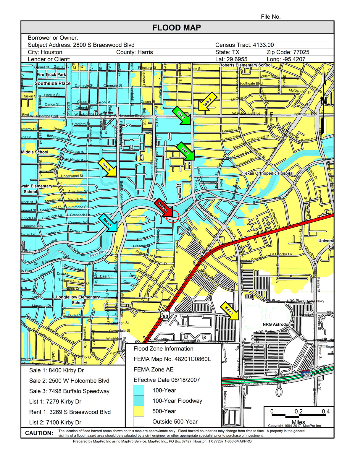
Flood MapMapPro has put an end to copying, cutting, pasting, and splicing those FEMA paper Flood Maps. MapPro provides FEMA Flood Hazard Maps for all areas where they are available, and always completely updated. These Flood Maps are a very valuable tool that can to help determine the flood risk for properties. FEMA FIRM panel number along with flood zone and date and revision of the panel are provided. Forget about mapping your sites twice – MapPro can generate all your street and Flood maps at once!
|
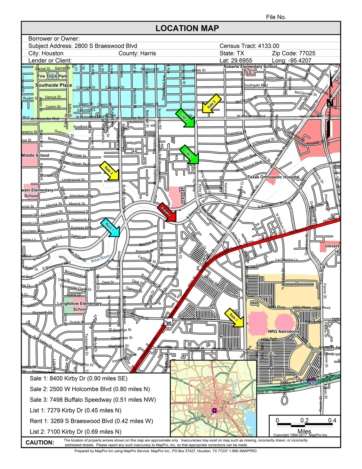
Location MapContains streets, railroads, streams, rivers, bayous, lakes, points of interest such as schools, hospitals, fire stations, police stations, post offices, churches, cemeteries, parks, golf courses, runways, and more. It also contains areas such as shopping centers, airports, universities, major parks, and stadiums. Several boundary layers are also provided including cities, zip codes, and census tracts. Included with the census tracts are dozens of fields of demographic information from 2020 census statistics.
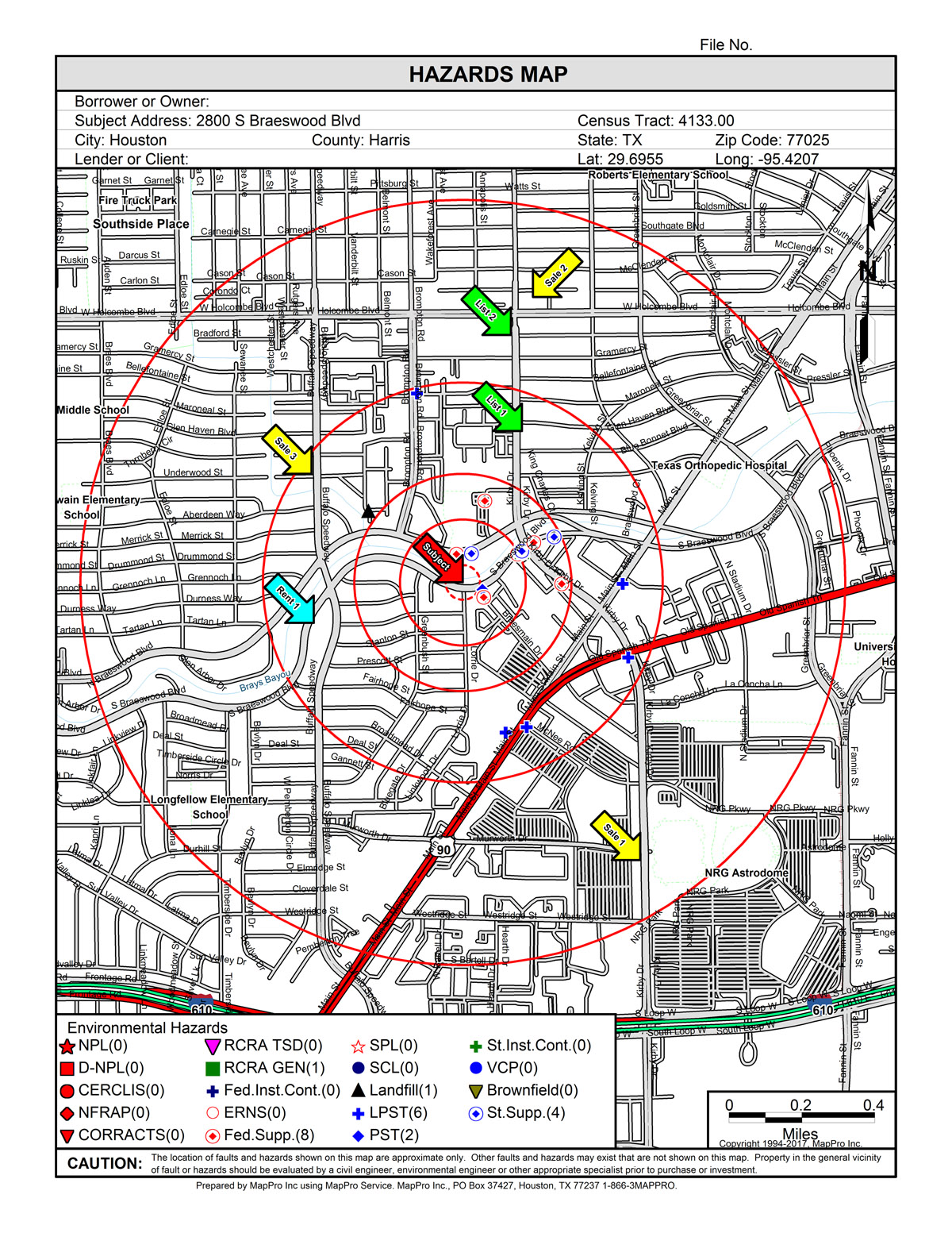
Hazards MapThe risk of environmental hazards is becoming more and more important. MapPro provides data for every state totaling more than 400 different datasets across the country. MapPro can provide you a warning that your site might be affected by a nearby source of contamination. For more information, MapPro can provide a regulatory records report for a specific property location detailing any issues of concern. |